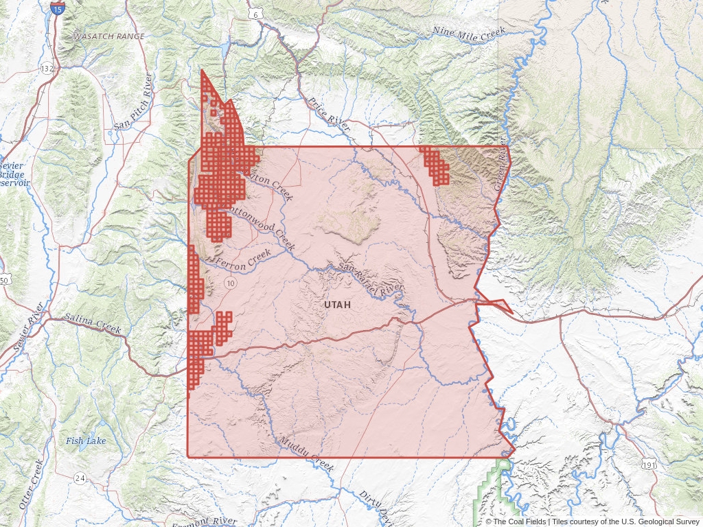
Emery County, Utah has 260 records of coal leases on public land managed by the Bureau of Land Management.
Quick Facts
- 260 records of coal leases on public land managed by the Bureau of Land Management.
- 53 authorized coal leases
- 10 pending coal leases
- 58,152 authorized coal acres
- 34,771 pending coal acres
- 197 closed coal leases
Leases Summary
in Emery County, Utah
- 260 Total
- 53 Authorized
- 10 Pending
- 197 Closed
Recently Updated Coal Leases
Most recently updated leases in Emery.
-
Uinta Basin Coal Lease
- 400 acres Authorized disposition
- Emery, Utah
- Cop Coal Development Co.
- Coal Lease
Read More -
Uinta Basin Coal Lease
- 320 acres Authorized disposition
- Emery, Utah
- ANR Inc.
- Coal Lease
Read More -
Uinta Basin Coal Lease
- 1.4K acres Authorized disposition
- Emery, Utah
- Cop Coal Development Co.
- Coal Lease
Read More -
Uinta Basin Coal Lease
- 1.11K acres Authorized disposition
- Emery, Utah
- Cop Coal Development Co.
- Coal Lease
Read More -
Uinta Basin Coal Lease
- 80 acres Authorized disposition
- Emery, Utah
- Cop Coal Development Co.
- Coal Lease
Read More
Coal Leases (BLM)
Emery County, Utah has 260 coal leases on public land listed in The Coal Fields™. Of these leases, 20.38% are authorized while 75.77% are now closed.
Quick BLM Facts
- 260 records of coal leases on public land managed by the Bureau of Land Management.
- 53 records of authorized coal leases
- 10 records of pending coal leases
- 197 records of closed coal leases
Lease By Disposition
In Emery
| claim | Leases |
|---|---|
| Closed | 75.77% (197 Leases) |
| Authorized | 20.38% (53 Leases) |
| Pending | 3.85% (10 Leases) |
Coal Trends
Popular Public Lands & Regions
in Emery County, Utah
Top Owners
in Emery County, Utah
Popular Towns, Cities, Etc.
in Emery County, Utah
Coal Lease News From The Coal Fields™
Learn more about the Bureau of Land Management, Public Land Survey System, and coal leases.
-

Understanding Lease Ownership
We receive lots of emails from people who find their name or a relative’s name on our site and want to know if this means they have some right to the land listed under that name.
-

Understanding BLM Administrative Areas
Whether it is filing a lease or researching one, the administering BLM office is going to be the definitive source.
-

Understanding Location Data
Lease handled by the Bureau of Land Management are not mapped by latitude and longitude, instead, these leases harken back to the Public Land Survey System.
-

Understanding Townships
A “township” can refer to two different things. Both are part of the PLSS measurement system but have different uses.
Join our mailing list to get alerts for lease listing updates, new features, and special opportunities.


