Carbon County, Utah has 107 records of coal leases on public land managed by the Bureau of Land Management.
Quick Facts
- 107 records of coal leases on public land managed by the Bureau of Land Management.
- 23 authorized coal leases
- 184,207 authorized coal acres
- 84 closed coal leases
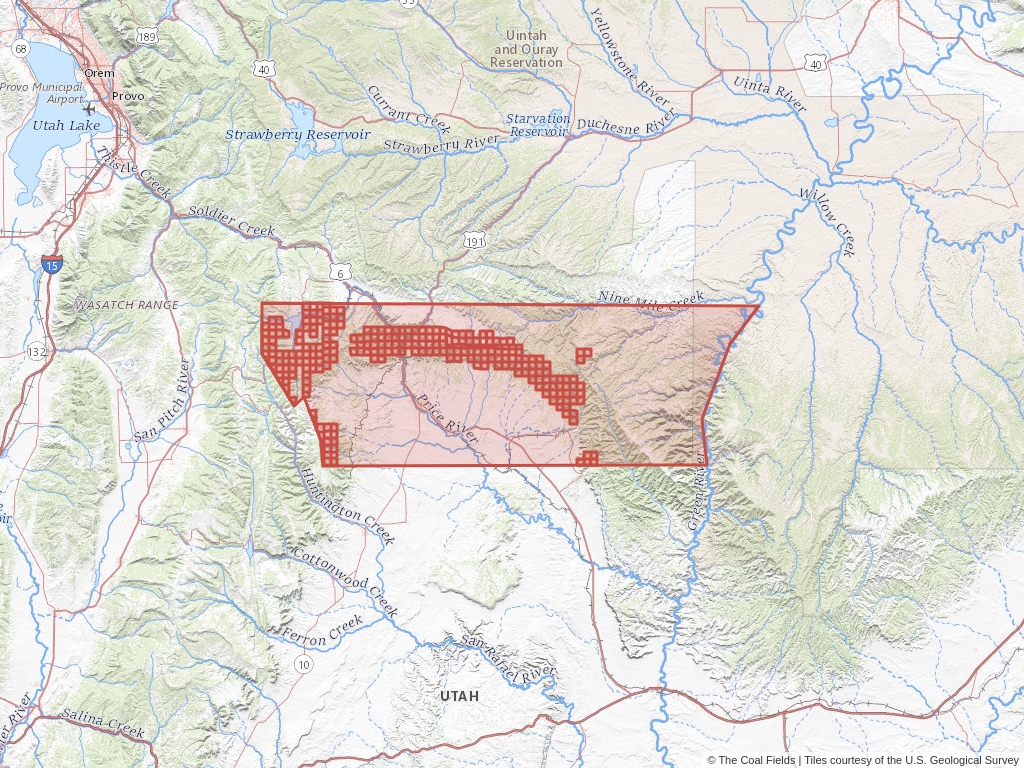
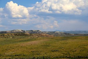
Carbon County Coal Mining Leases
Click to open an interactive map.
© The Coal Fields™
Recently Updated Coal Leases
Most recently updated leases in Carbon.
Coal Leases (BLM)
Carbon County, Utah has 107 coal leases on public land listed in The Coal Fields™. Of these leases, 21.5% are authorized while 78.5% are now closed.
Quick BLM Facts
- 107 records of coal leases on public land managed by the Bureau of Land Management.
- 23 records of authorized coal leases
- 84 records of closed coal leases
Coal Trends
Popular Public Lands & Regions
in Carbon County, Utah
Land TypeTotal LeasesPending LeasesClosed LeasesExpired LeasesCancelled LeasesWithdrawn LeasesRelinquished LeasesRejected LeasesPending Acres
Uinta Basin
Oil and Gas
104
0
82
0
0
0
0
0
0
Uinta-Piceance
Oil and Gas
104
0
82
0
0
0
0
0
0
Manti-La Sal National Forest
National Forests
32
0
23
0
0
0
0
0
0
Top Owners
in Carbon County, Utah
CityStateCategoryInterest RelationshipTotal LeasesPending LeasesClosed Leases
Canyon Fuel Co.
Sandy
Utah
Corporation
Licensee
21
0
9
Cw Mining Co.
Huntington
Utah
Corporation
Assignee
1
0
0
Coop Mining Co.
Huntington
Utah
Corporation
Applicant
1
0
0
Gentry Mountain Mining LLC
Salt Lake City
Utah
Corporation
Operating Rights
1
0
0
Utah Land Resources Inc.
Saint Clairsville
Ohio
Corporation
Operator
9
0
1
Popular Towns, Cities, Etc.
in Carbon County, Utah
CountyStateTotal LeasesPending LeasesClosed LeasesExpired LeasesCancelled LeasesWithdrawn LeasesRelinquished LeasesRejected LeasesPending Acres
Wattis
Carbon
Utah
161
2
119
0
0
0
0
0
920
Hiawatha
Carbon
Utah
160
2
119
0
0
0
0
0
920
Clear Creek
Carbon
Utah
140
2
105
0
0
0
0
0
920
Scofield
Carbon
Utah
129
2
101
0
0
0
0
0
920
Spring Glen
Carbon
Utah
102
0
76
0
0
0
0
0
0
Coal Lease News From The Coal Fields™
Learn more about the Bureau of Land Management, Public Land Survey System, and coal leases.
-

Understanding Lease Ownership
We receive lots of emails from people who find their name or a relative’s name on our site and want to know if this means they have some right to the land listed under that name.
-
Understanding BLM Administrative Areas
Whether it is filing a lease or researching one, the administering BLM office is going to be the definitive source.
-
Understanding Location Data
Lease handled by the Bureau of Land Management are not mapped by latitude and longitude, instead, these leases harken back to the Public Land Survey System.
-
Understanding Townships
A “township” can refer to two different things. Both are part of the PLSS measurement system but have different uses.