Rio Blanco County, Colorado has 63 records of coal leases on public land managed by the Bureau of Land Management.
Quick Facts
- 63 records of coal leases on public land managed by the Bureau of Land Management.
- 12 authorized coal leases
- 40,143 authorized coal acres
- 51 closed coal leases
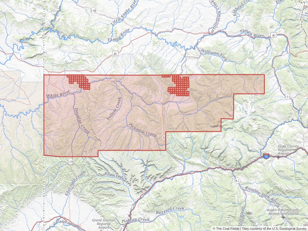
Rio Blanco County Coal Mining Leases
Click to open an interactive map.
© The Coal Fields™
Recently Updated Coal Leases
Most recently updated leases in Rio Blanco.
Coal Leases (BLM)
Rio Blanco County, Colorado has 63 coal leases on public land listed in The Coal Fields™. Of these leases, 19.05% are authorized while 80.95% are now closed.
Quick BLM Facts
- 63 records of coal leases on public land managed by the Bureau of Land Management.
- 12 records of authorized coal leases
- 51 records of closed coal leases
Coal Trends
Popular Public Lands & Regions
in Rio Blanco County, Colorado
Land TypeTotal LeasesPending LeasesClosed LeasesExpired LeasesCancelled LeasesWithdrawn LeasesRelinquished LeasesRejected LeasesPending Acres
Piceance Basin
Oil and Gas
38
0
29
0
0
0
0
0
0
Uinta-Piceance
Oil and Gas
38
0
29
0
0
0
0
0
0
Top Owners
in Rio Blanco County, Colorado
CityStateCategoryInterest RelationshipTotal LeasesPending LeasesClosed Leases
Blue Mountain Energy Inc.
South Jordan
Utah
Corporation
Lessee
8
0
0
Colowyo Coal LP
Meeker
Colorado
Corporation
Lessee
1
0
0
Western Fuels-Utah
Lakewood
Colorado
Corporation
Lessee
2
0
2
Popular Towns, Cities, Etc.
in Rio Blanco County, Colorado
CountyStateTotal LeasesPending LeasesClosed LeasesExpired LeasesCancelled LeasesWithdrawn LeasesRelinquished LeasesRejected LeasesPending Acres
Meeker
Rio Blanco
Colorado
37
0
30
0
0
0
0
0
0
Rangely
Rio Blanco
Colorado
23
0
14
0
0
0
0
0
0
Rio Blanco
Rio Blanco
Colorado
1
0
1
0
0
0
0
0
0
Coal Lease News From The Coal Fields™
Learn more about the Bureau of Land Management, Public Land Survey System, and coal leases.
-

Understanding Lease Ownership
We receive lots of emails from people who find their name or a relative’s name on our site and want to know if this means they have some right to the land listed under that name.
-
Understanding BLM Administrative Areas
Whether it is filing a lease or researching one, the administering BLM office is going to be the definitive source.
-
Understanding Location Data
Lease handled by the Bureau of Land Management are not mapped by latitude and longitude, instead, these leases harken back to the Public Land Survey System.
-
Understanding Townships
A “township” can refer to two different things. Both are part of the PLSS measurement system but have different uses.