West Black Thunder Lba Competitive Coal Lease
Thunder Basin Coal
43.6937°N 105.3027°W
43.6937°N 105.3027°W
West Black Thunder Lba Competitive Coal Lease is a 3,492.49-acre authorized coal lease in Campbell, Wyoming owned by Thunder Basin Coal.
Ownership and use of this lease is overseen by the Bureau of Land Management's Buffalo Field Office under the serial number WYW 118907. The last action for this lease occurred on October 1, 2022. Information on the lease was last updated on February 15, 2022.
This Nonreg Competitive Coal Lease by Application falls under U.S. Code Title 30 Mineral Lands and Mining; Section 181; Statute 041; Page 0438. Mineral Leasing Act of 1920. An Act to Promote the Mining of Coal, Phosphate, Oil, Oil Shale, Gas, and Sodium on the Public Domain.. (1920-02-25)
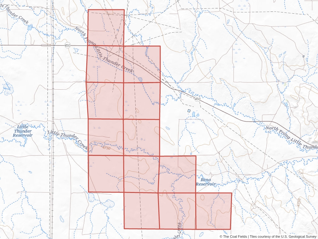
Click to open an interactive map.
© The Coal Fields™
Other leases near West Black Thunder Lba Competitive Coal Lease.
North Roundup/North Rochelle Mine Competitive Coal Lease
Powder River Basin Competitive Coal Lease
South Hilight Field Competitive Coal Lease
Jacobs Ranch Mine Coal Lease Exchange
Little Thunder Competitive Coal Lease
* Lease bounds on map indicate the general area that a lease occupies. For an detailed map, refer to the overseeing BLM field office.
** The lease central point is based on an average of the lease's bounding box(es) and does not necessarily fall on the claim itself.
Learn more about the Bureau of Land Management, Public Land Survey System, and coal leases.
Understanding Lease Ownership
We receive lots of emails from people who find their name or a relative’s name on our site and want to know if this means they have some right to the land listed under that name.

Understanding BLM Administrative Areas
Whether it is filing a lease or researching one, the administering BLM office is going to be the definitive source.

Understanding Location Data
Lease handled by the Bureau of Land Management are not mapped by latitude and longitude, instead, these leases harken back to the Public Land Survey System.

Understanding Townships
A “township” can refer to two different things. Both are part of the PLSS measurement system but have different uses.